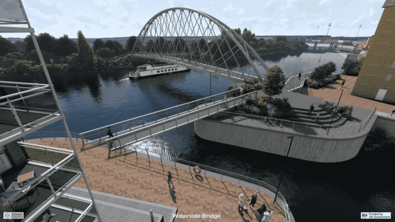
Nottingham’s new Transforming Cities-funded pedestrian and cyclist bridge across the River Trent is now open to the public! The new bridge officially opened on 2 June 2026.
Click here to open a pdf of the plan
You’ll find information on the bridge project, next steps, background to this project and an FAQ on this page.
Latest News and Updates
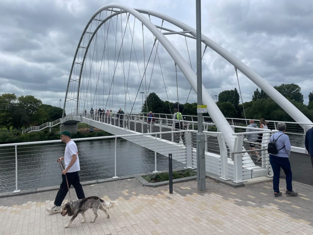
Waterside Bridge is now open!
Nottingham’s newest bridge opened to the public on 2 June, and has been incredibly popular and busy with visitors since then despite the rainy weather. Thank you to everyone who’s come along to check it out.
- Thank you for your patience as we continue to work on the walking and cycling link to Poulton Drive – this will open on Thursday 18 June by 12noon
- We’ve updated our bridge FAQs with some new question and answers below
How do I visit the new bridge?
By foot or bike, check the map above
By bus –
- Catch NCT 45 from the city centre or Carlton / Netherfield and alight on Daleside Road close to Poulton Drive
- Catch NCT 90, 90X or 11, 11B, 11C and alight at Nottingham Rugby Ground
By car – the closest public parking available is at The Hook, off Holme Road which is around a 5 minute walk to the bridge.
Please be aware that the Trent Basin housing development is subject to a residents parking permit scheme Monday – Saturday so you may not park there unless you are visiting someone who lives nearby.
Can I put a lock on the new bridge?
Padlocks will be immediately removed from the bridge, so please don’t waste your time.
Is the bridge covered by CCTV?
Yes! It is covered by CCTV monitored by Nottingham City Council’s control room.
What’s next?
Nottingham City Council colleagues are busy working on improving onward connections to the bridge and our wider walking and cycling networks.
Next on their radar is a continuation of the Poulton Drive / Daleside Rd cycle scheme which will provide an improved connection back to our cycling network and onto the city centre.
We will be upgrading large island where Daleside Road meets Manvers Street to make it a better place to navigate as a cyclist and pedestrian
- providing toucan crossings for pedestrians and cyclists. These signals are getting to their end of their life and are in need of refurbishment, as such this scheme will upgrade all the signal poles, heads and controllers whilst simultaneously providing new and improved cycle crossing facilities
- improving and extending footpaths and shared spaces
Interested in knowing how the bridge was built and lifted into place? This animation gives you insight into what has been happening day by day, as well as showing how the bridge was lifted into place and how it will look once it is all complete.
Past News and Updates
The new cycle path and resurfaced footpath connection to the bridge from Daleside Road will not yet be open when the bridge opens on Tuesday 2 June. It is expected to open shortly after. Until then, access is available via Trent Lane / Portside.
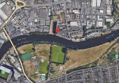
Check out the map showing ongoing connections from the bridge below, including to Colwick Country Park , Colwick Woods, Sneinton, the city centre and Holme Pierrepont, Lady Bay, Gamston and riverside paths on the south side.
Nottingham’s new walking and cycling bridge will open on Tuesday 2 June. After a ribbon cutting ceremony where children from local schools will join Councillors and other officials to declare the crossing open, the bridge will be open for the public to cross for the first time from 12noon, along with the new bridge over Trent Basin. The newly widened and surfaced riverside footpath on the south side of the river will also re-open for use on 2nd June.
To celebrate the opening of the bridge, there will also be a free community fun day on Sunday 14 June 2026, with activities and stalls on both the north and south banks of the river, including food and drink, community performances, free activities for children and adults including crafts, face painting and games and a focus on STEM (science technology, engineering and maths) and sports activities.
March 2026
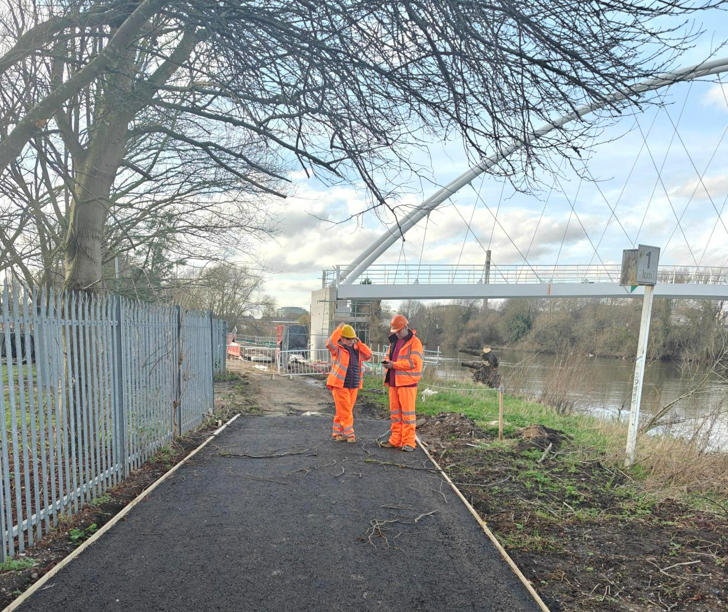
Work continues going well at the bridge site as we prepare to open the new bridge later this spring.
Upgrades to the riverside path are going well but are not yet complete, with the top surface still to go on. It will re-open at the same time as the new bridge opens.
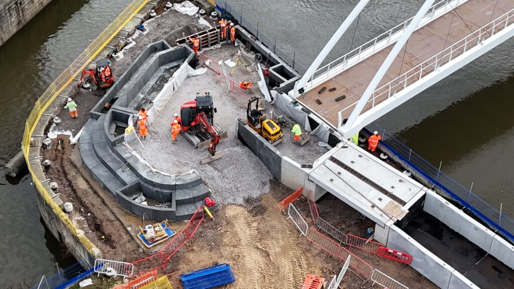
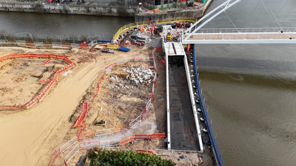
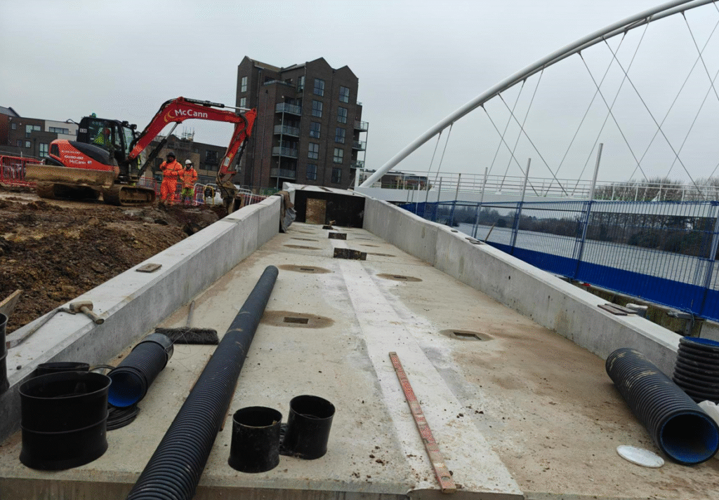
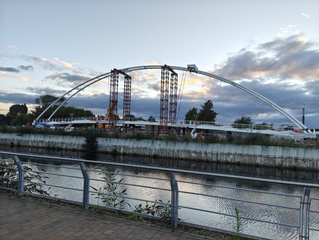
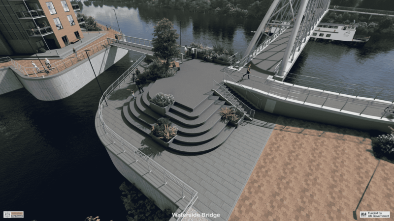
Amphitheatre (the spiral/ shell shaped section approaching the bridge with built in seating and planting) works are continuing as shown in the below pictures.
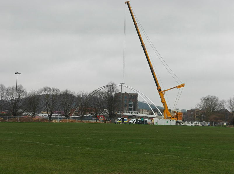
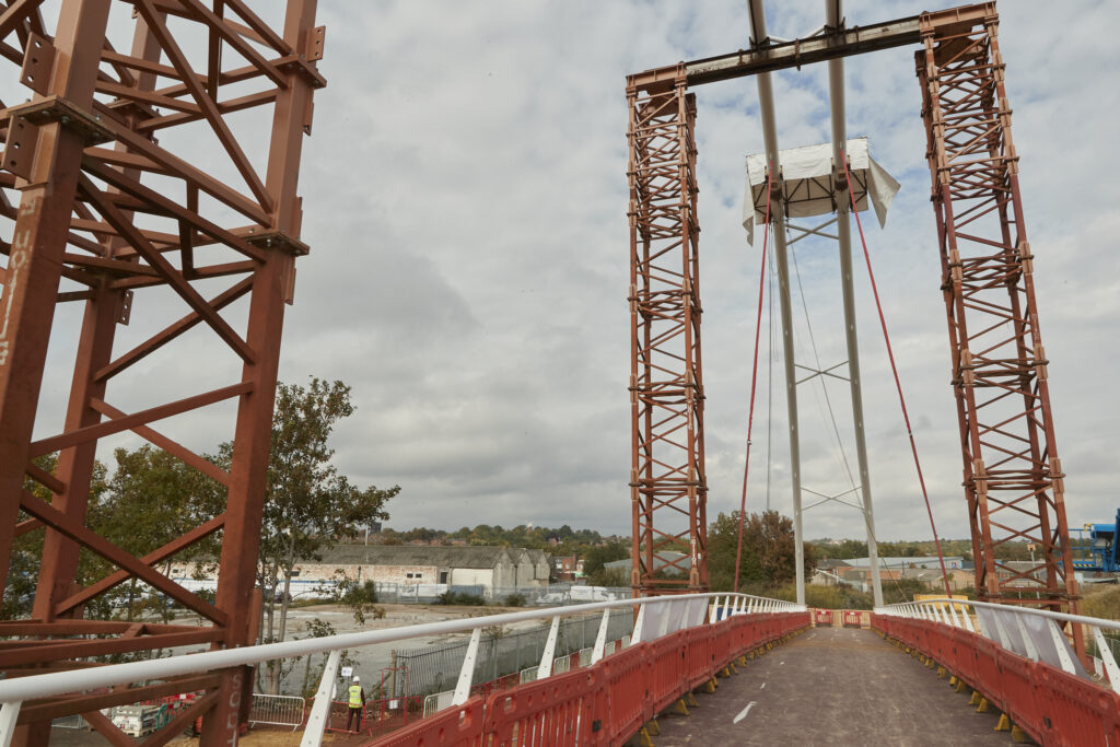
This week (week commencing 9 March), the southside ramps and stairs start coming to site for installation with a large crane on site for around two weeks to lift them into place.
January 2026
- We’re now working on walking and cycling connections to the new bridge along Daleside Road and Poulton Drive – they will benefit from new cycling and walking infrastructure that will help safely link up those on bike and on foot with the new bridge. The project includes a 3-metre shared use path along the southern side of the pavement on Daleside Road, including a new planting area providing separation between the new path and the road. It’s being funded by EMCCA.
- On the south side, we’ve begun work on a flood storage compensation area which has meant we’ve shut the footpath from Holme Road for a few weeks
- On site, work is taking place to prepare the area ready for the smaller basin bridge and the ramps and footpaths that will lead to the main bridge on each side of the river
12 November 2025
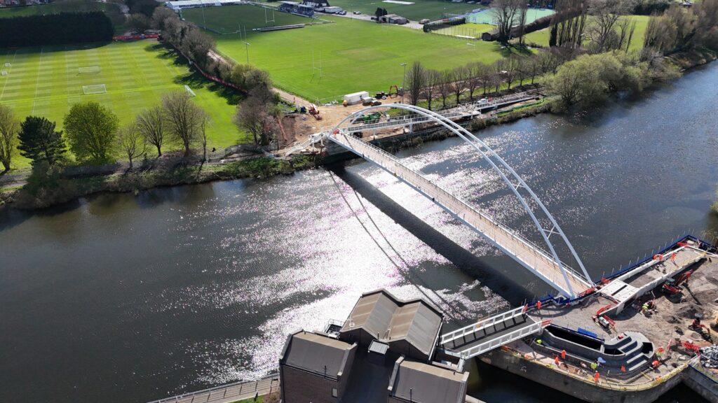
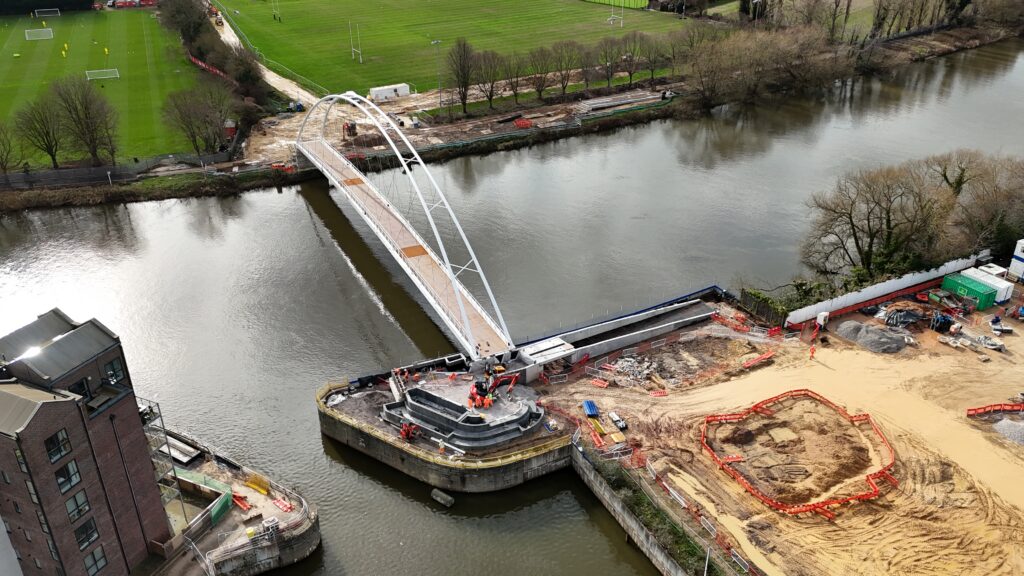
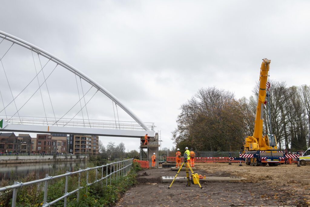
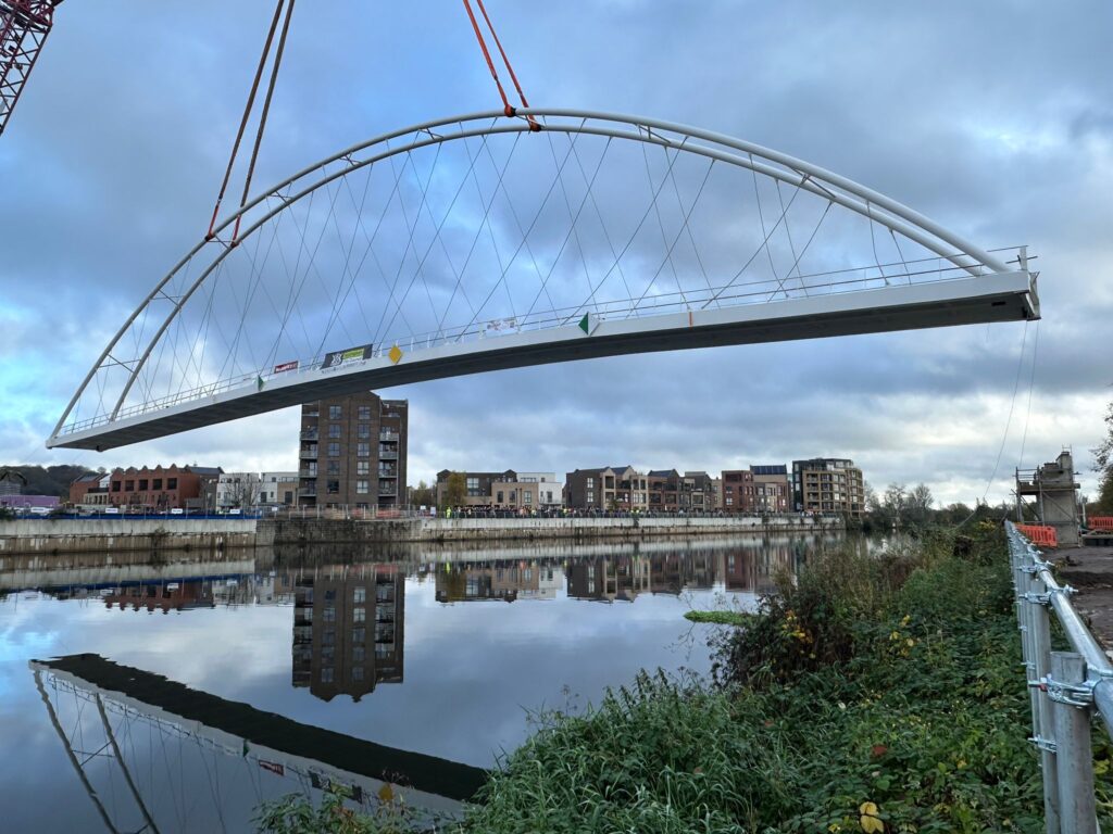
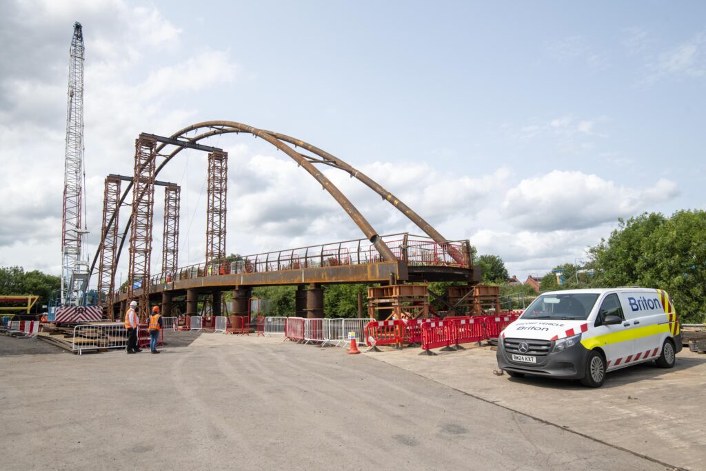
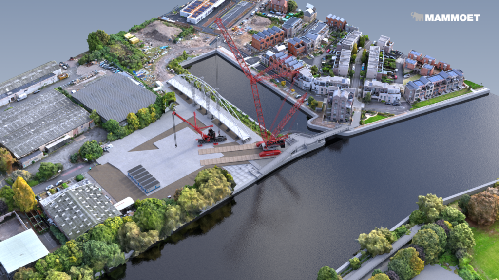
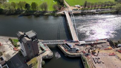
Nottingham’s new walking and cycling bridge was successfully lifted into place on Monday 10 November.
October 2025
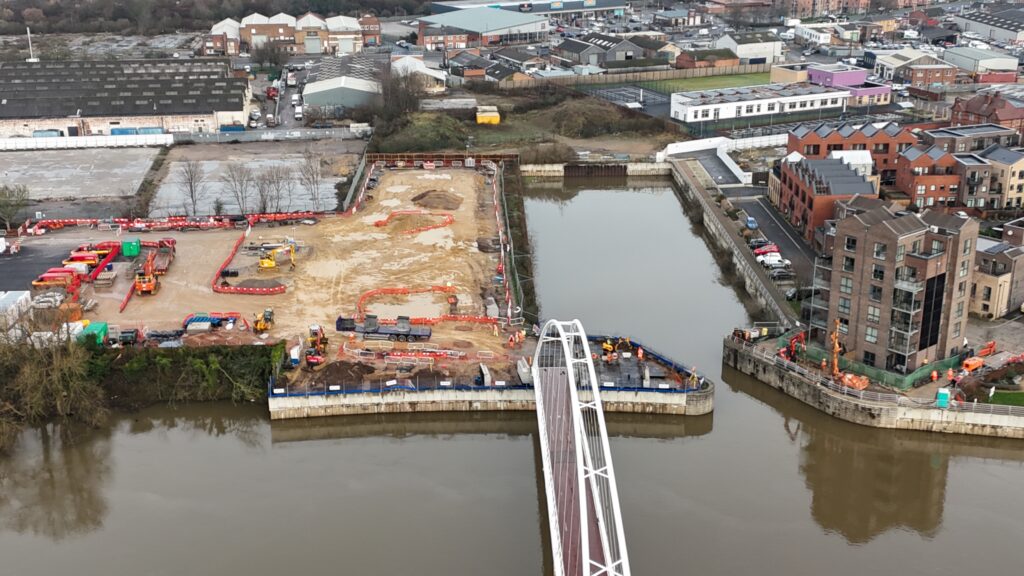
 Partners including the funders of our bridge project, the Department for Transport, visited the riverside where the 87metre, 175tonne bridge is awaiting being lifted into place.
September 2025
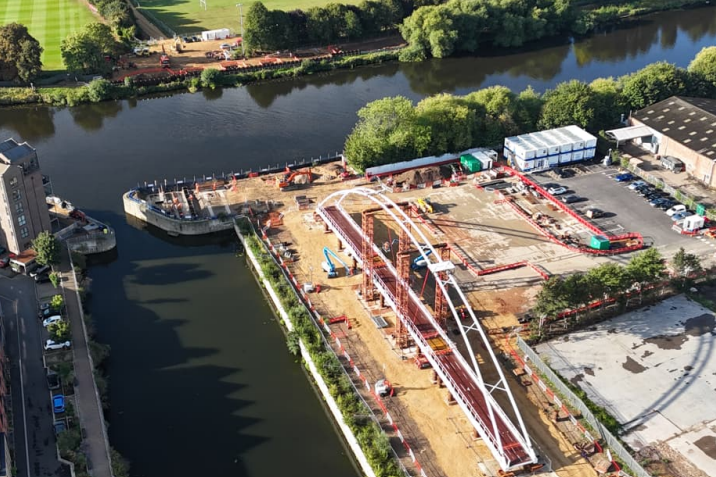
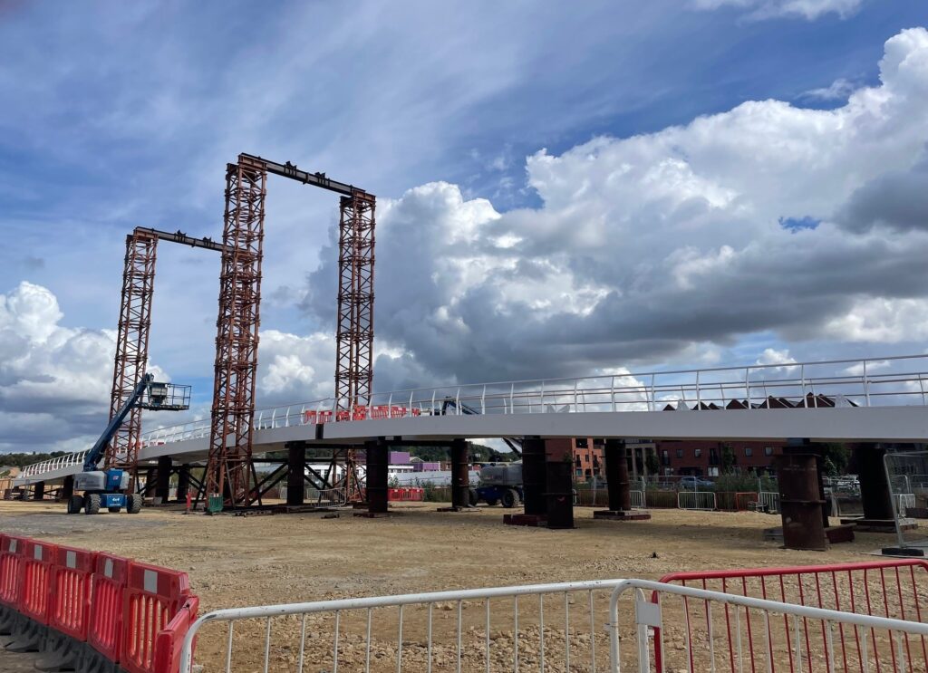
On the north bank of the river, the bridge structure has arrived on site fresh from the painters and is now being assembled and checked. Reinforced concrete works to the bridge abutments and foundations for the amphitheatre is progressing well.
Next, the concreting works to the bridge will be completed, with reinforced concrete works to the ramps continuing. Works assembling the bridge will continue with the sections being welded together, the deck completed and other finishing works.
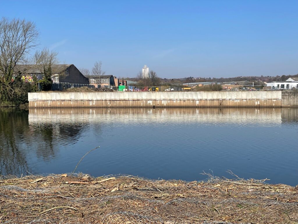
On the south bank, a sheet piling wall has been installed parallel to the waters edge and concrete piles have been installed ahead of reinforced concrete works to the bridge starting next month.
Next on the south bank, reinforced concrete works to the bridge abutments and ramp foundations will begin.
We’re getting closer to the completed bridge being be lifted into place on its supports by a huge crane this November!
August 2025
Exciting news – the steel bridge structures have arrived back in Nottingham after a trip to a specialist paint yard.
- The bridge is now being assembled at Trent Basin, the deck sections of the bridge that arrived in the week commencing 18th August have now been lifted into place along side the basin and during the first week of September, the arch sections are arriving on site for installation
- Works have begun to prepare the surface that the huge crane will sit on when it lifts the bridge into place
July 2025
Recently, on site:
- piling works have been ongoing to create the foundation for the bridge structure and its ramps
- a temporary sheet pile has been added adjacent to the river edge to hold the bank in place
- a platform has been created to hold the crane that will lift the bridge into place over the river this November
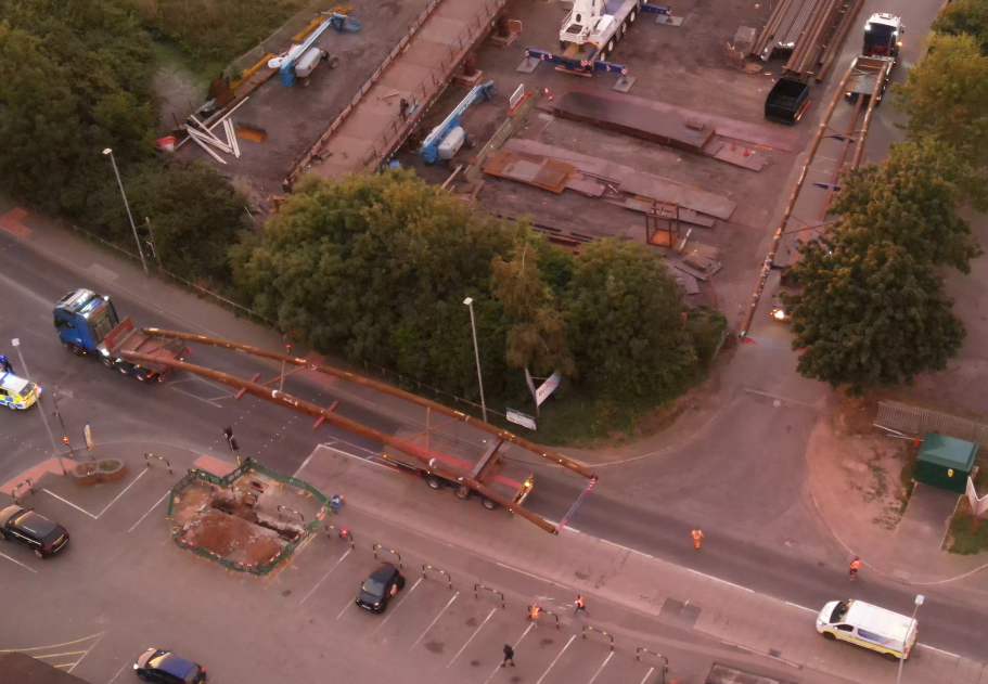
Meanwhile, at Briton’s in Hucknall, where the bridge has been being constructed using British steel, the bridge structure left site in sections with a police escort to go to a specialist yard to be painted. It will return to Nottingham later this month to be re-assembled at the riverside before a giant crane lifts it into place this autumn.
June 2025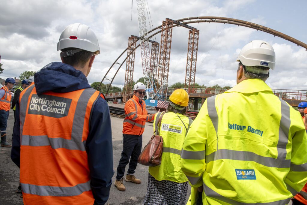
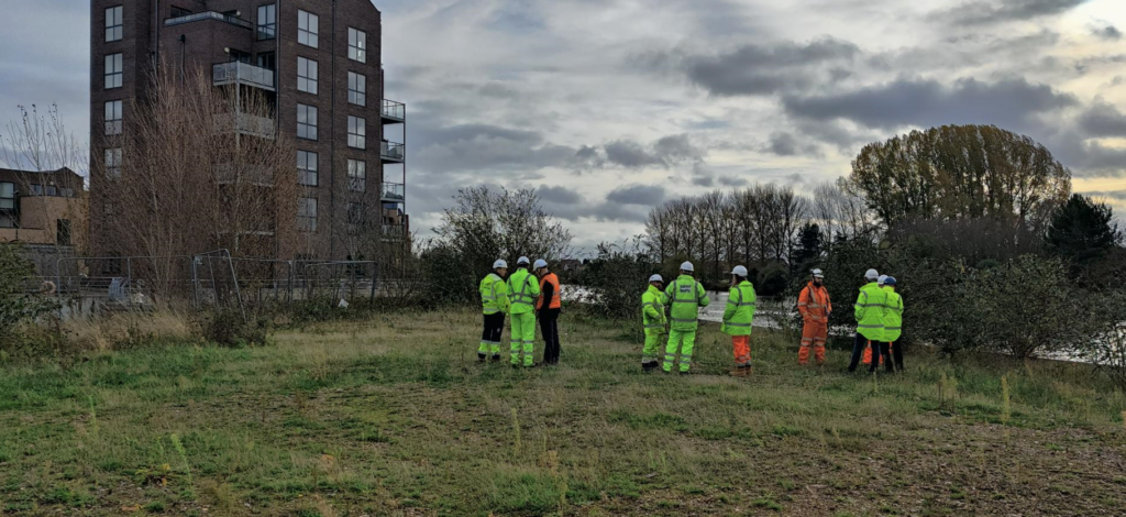
In early June, Nottingham City Council along with partners Balfour Beatty, Pick Everard and Rushcliffe Borough visited Nottingham’s brand new bridge at Briton Steel Fabricators in Hucknall.
The bridge has been constructed on site using British Steel, and will soon be disassembled and painted at a specialist painters before arriving on site at Trent Basin this August.
April 2025
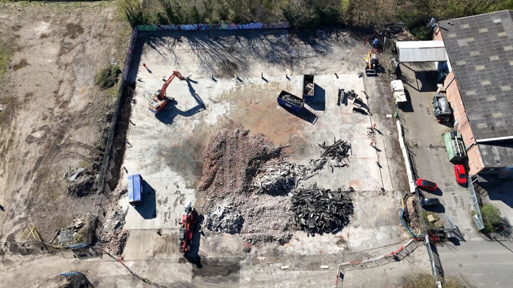
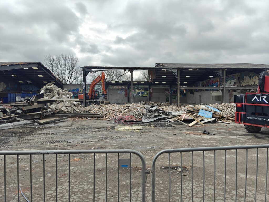
- The warehouse that used to house Flo Skatepark has now been demolished – making the space needed to assemble the massive bridge and for a crane to lift it into place this autumn
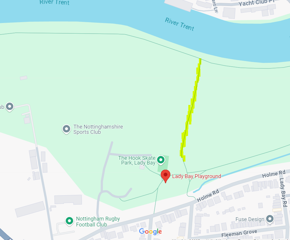
- Thank you for your patience while the path between the river and playparks at the Hook, Holme Road, Lady Bay, was closed. The path has now been transformed from rocky and muddy to smooth and flat tarmac. It will be much better for all users, but especially those using a scooter, bike, wheelchair or pushchair and will form a key part of our diversion while the riverside path is closed.
- The path along the riverside between Lady Bay Bridge and where it meets the path to the playpark, shown in red below, is now closed from 5 May until spring 2026 when the bridge opens. We apologise both for the inconvenience and length of closure which is necessary while we build and lift the bridge into place, as well as making improvements to this footpath. Pedestrian and bike diversion routes are shown on our map
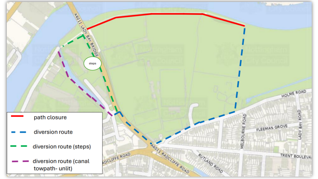
© Crown Copyright and Database Rights 2025 OS AC0000822898.
March 2025
- Clearance of vegetation has taken place on site, preparing the bank where the bridge will land
- Work has begun to demolish the warehouse which housed Flo Skate Park
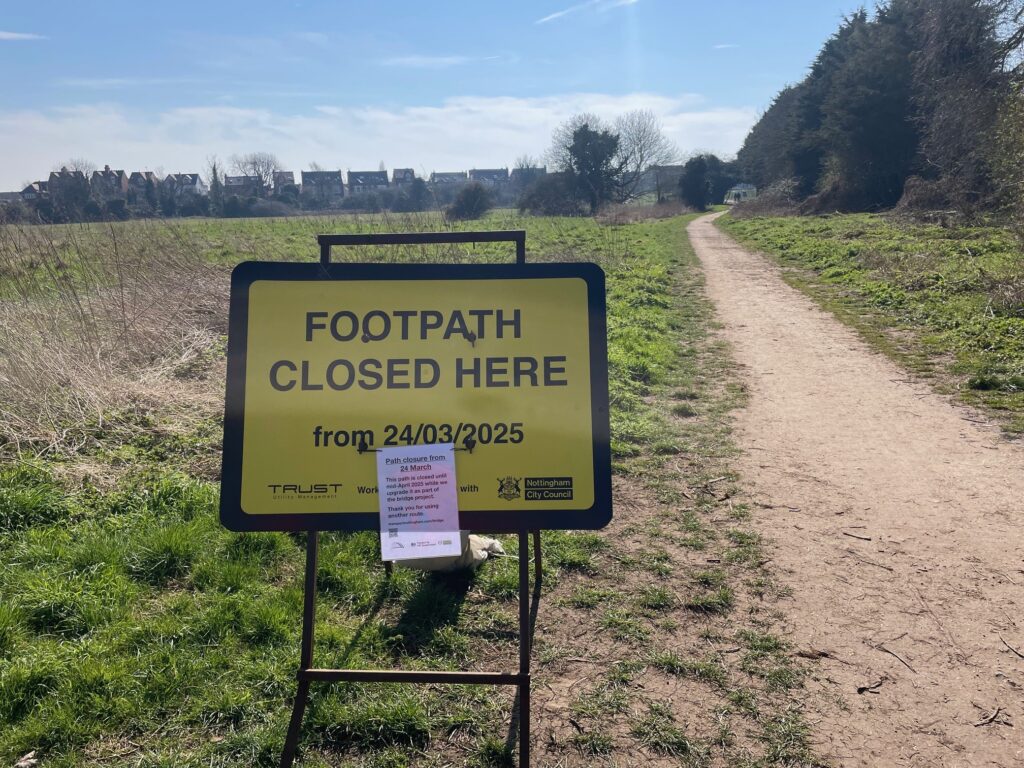
- The footpath between the playparks at the Hook and the river, on the south side of the river, is now closed until late April while its being upgraded as part of the bridge project. The stone path will be replaced by a 3metre tarmac path – more details here. Thank you for using another route while we carry out this upgrade.
© Crown Copyright and Database Rights 2025 OS AC0000822898.
What’s happened so far?
2020 – Secured Government funding through the Transforming Cities Fund
2021 – Option appraisal of bridge locations undertaken by Amey Consulting.
Environmental surveys, flood modelling and stakeholder engagement carried out
November 2021 Public invited to share their views on the preferred scheme location
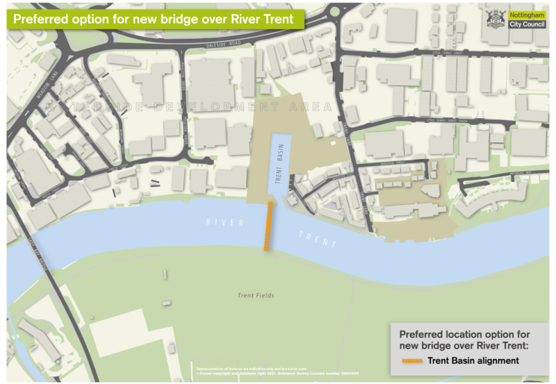
December 2021 Nottingham City Council Executive Board approved the location of the bridge at Trent Basin, and gave approval to progress the scheme and submit a planning application
2022 We reviewed feedback from the public, which resulted in the width of the bridge being increased to 4m and additional connecting routes being considered
2022 We engaged with a contractor (Balfour Beatty) to to clarify key areas including costs buildability, how the bridge will be constructed on site and the land take requirements for this.
2022 & 2023 The project team have continued to work with adjacent landowners to map out the processes to secure agreements to construct the bridge and connect it to the existing highway network.
2022 & 2023 Further work was undertaken to support the planning application submission including flood modelling and environmental surveys such as tree, bat, water vole and other vegetation and species surveys. Work has also progressed to determine the construction methodology including the proposed construction haul routes.
2024 – detailed design work, ground and ecological surveys, scheme order confirmation, detailed construction methodology planning, land agreements negotiated,
February 2024 – We submitted planning applications in February 2024 which have now been approved.
December 2024 – Nottingham City Council have received a confirmation instrument from the Department for Transport
January 2025 – Nottingham City Council has entered into contract with lead delivery partner Balfour Beatty who will build the bridge
Construction timeline
- February/March: Site clearance including vegetation clearance and demolishing a warehouse formerly used by Flo skate park
- March: Balfour Beatty will bring equipment, materials and cabins to site
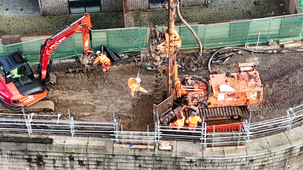
- April onwards: Pilings are screwed into the ground to support the bridge structure
- Summer – autumn: The bridge will be built on site using large, prefabricated sections of steel arriving from local company Briton Fabricators Ltd, based just eight miles away in Hucknall
- November: The completed bridge and basin bridge will be lifted into place on its supports by a huge crane
- Winter 25/26: Ramps, steps and hard and soft landscaping completed including paving, planting and lighting
- Spring 2026: The new bridge opens
Cost
The current cost for the entire project is £18million, with funding set aside within the Transforming Cities Fund programme to deliver the scheme.
Since the project began, plans have evolved as the design and methods of construction have been refined and this along with other factors outside of the Council’s control, have impacted the cost. These include:
- widening the bridge from the original proposed width of 3.5m to 4m, following feedback from the public at the consultation stage
- large increases in inflationary pressures especially impacting the cost of construction and materials
- as we clearly said throughout, the final cost would be subject to our project teams fleshing out the construction planning and logistics with our delivery partner
Background to the project
The Waterside Bridge will be the first bridge to be built over the Trent in Nottingham since Clifton Bridge in 1958, and will open up new, safer commuter and leisure routes, offering a huge boost to cyclists, pedestrians and runners alike.
By enhancing connections between communities, green spaces and riverside paths, the proposed scheme will make it easier for people living and working in the Nottingham area to travel in a more sustainable way.
In addition, new and enhanced connecting paths and crossing points will be developed, which will connect the bridge to the wider walking and cycling network, providing access to housing, employment and leisure opportunities across the city and beyond.
The new bridge will also provide strong links between exciting new developments in the Island Quarter, significant housing growth taking place in West Bridgford, and Nottingham city centre.
It will also provide easier access to green and open space south of the river, as well as the sports grounds, for people living in communities such as Sneinton and the city centre.
The project is being led by Nottingham City Council, working in partnership with Rushcliffe Borough Council and in consultation with Nottinghamshire County Council.
The need for a bridge was identified in the City Council’s Waterside Supplementary Planning document in 2019. The council secured funding from the Government’s Transforming Cities programme to deliver this scheme as part of a programme to invest in local transport infrastructure that will improve sustainable transport, support growth, and encourage more low carbon journeys.
Frequently Asked Questions
Why has Trent Basin been chosen as the location?
The City Council in partnership with the neighbouring local authorities of Derby, Derbyshire and Nottinghamshire examined the strategic cycle and walking network and recognised the need for more places to be able to cross the Trent safely.
This supports earlier work undertaken as part of the Waterside Regeneration Area consultation, where the idea of a new pedestrian and cycle bridge in the proposed location was first put to the public.
The new bridge, for walking and cycling, will open up new, quieter routes for travel and will also create new opportunities for local trip making and build upon the increase in cycling and walking trip making that was observed during lockdown.
The bridge will greatly improve connectivity in the Waterside area, but the benefits will also be seen by people living much further afield. There is huge demand for travel over the Trent and a new bridge will enable people to have a greater travel choice by opening up walking and cycling as an option as part of the commute and for leisure.
We also know there is a demand for better walking and cycling routes on both Lady Bay Bridge and Trent Bridge. These do still feature in future plans and will be assessed against other improvements needed across the city, however a new bridge will greatly enhance the walking and cycling network and can be built and used without disruption or loss of capacity for public transport and other motorised transport.
What benefits will the new bridge provide?
The new bridge scheme will offer:
- a dedicated pedestrian and cycle bridge over the river Trent
- a new east-west connection over the head of Trent Basin (on the northern bank) to enable east-west connectivity alongside the river for cyclists and pedestrians
- new commuting route options for trips into Nottingham, the QMC, university sites and science parks from the south of the river
- a link across the river from the new housing and developments sites within the Waterside Regeneration Zone on the northern side to the green spaces on the south and to the National Water Sports Centre
- better access to the various sports grounds and sporting facilities in the area
- new opportunities for leisure trip making for pedestrian, runners and cyclists from either side of the river
- more circular route options for cyclists, walkers and runners who will be able to cross the Trent at the new bridge and use the existing bridges to create ‘loops’
- a safe and direct route connecting residents on the south of the river to Colwick Park (including Parkrun) on the north of the river, when combined with new path upgrade proposals on the northern side
- new and enhanced views of the river and its wildlife, and opportunities to get out and about supporting physical and mental well being
- Alleviation of traffic pressures on both Trent Bridge and Lady Bay bridge through increased sustainable travel
What new cycle paths or footpaths will connect with the bridge?
We want to ensure the Bridge is as well connected to the existing and expanded future network. We are therefore working with land owners to agree the best route and looking at design options to ensure both cyclists and pedestrians have good connections to onward routes. Once we have agreed the best routes and completed feasibility designs we will share them for comment. Improved crossing facilities over Daleside Road are included in this remit.
This process has begun and will build on the work undertaken over the last few years that saw an improved route along the River to the east and enhanced paths around Colwick Park.
Isn’t this work impacted by the City Council issuing a Section 114 notice?
The Waterside Bridge project is being delivered using grant funding secured from Central Government through the Transforming Cities programme.
While the Section 114 report means that money Nottingham City Council can spend is currently strictly controlled, because external grant funding has previously been specifically allocated and approved for this scheme it can go ahead.
They money allocated to us by Government from this fund cannot be spent on anything else.
Why have you chosen to locate a bridge here?
The location offers a good balance between providing for leisure and commuter use. It is down the river from Lady Bay bridge while being close enough to Colwick Park that when combined with proposed improvements to the paths along the banks of the Trent it will greatly improve access for walking and cycling.
Why don’t you just improve Lady Bay Bridge or Trent Bridge?
To provide a suitable route significantly more investment would be required on existing bridges. By focusing on a new bridge it also means there is significantly less disruption to travel while the bridge is constructed.
Why can’t this money be put toward a bridge for cars (such as the ‘fourth Trent Crossing’)?
The money has been provided by the Government to support sustainable travel. While not cheap, a walking and cycling bridge will cost significantly less than a bridge that can take motor traffic.
Encouraging more sustainable, lower carbon journeys is an important part of our plan to achieve Carbon Neutral Nottingham 2028. We need to create the necessary infrastructure to enable people to make smarter choices about how they travel, reducing our impact on climate change.
Will boats be able to sail under the bridge?
We are working closely with boat operators and sailing clubs and talking to the Canal and River Trust to ensure we accommodate the needs of existing users. The navigable height will allow clearance for a single handed sailing boat and for tourist/event boats. It is 6.4 metres above a water level of 21.00.
How wide is the bridge?
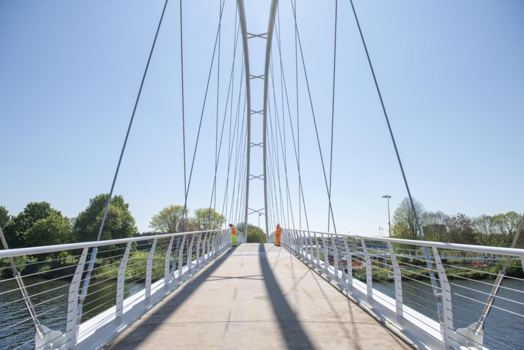
The bridge deck and ramps are 4m wide to allow pedestrians and cyclists to easily pass and allow people to stop and enjoy the view.
Will electric scooters be able to use the bridge?
Privately owned electric scooters can only be used on private land.
Nottinghamshire County Council does not currently permit a public e-scooter scheme, and as the bridge crosses the boundary between the city and county if the bridge was open now you would be able to get to the bridge on the north side using a dott e-scooter but you would not be able to cross.
How will you stop vehicles from using the bridge?
Suitable measures will be in place to prevent vehicles attempting to access the bridge through areas designated for walking and cycling. If necessary, measures will be placed on the bridge that will inhibit vehicles but not make it difficult for wheelchairs, adapted bikes, pedestrians or cyclists.
Downloads
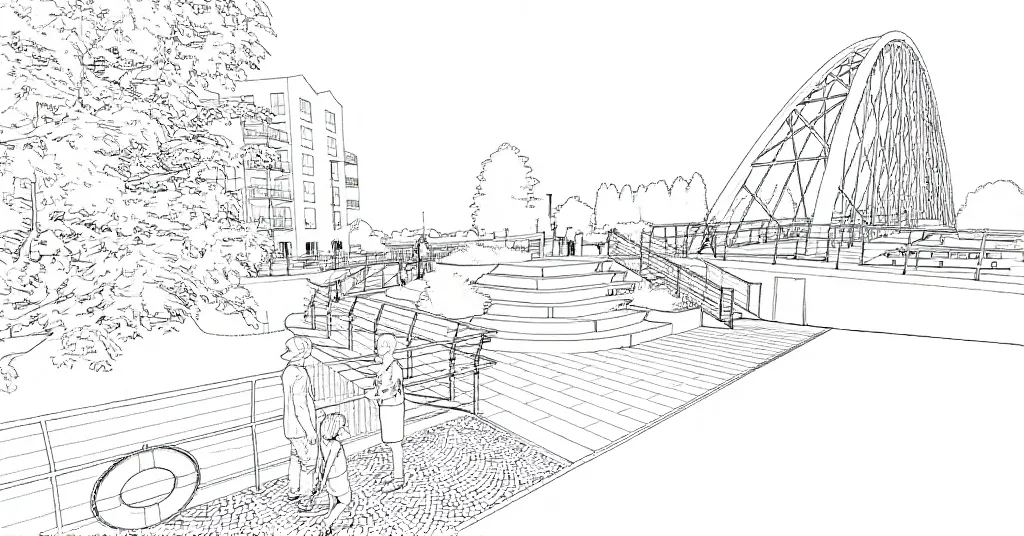
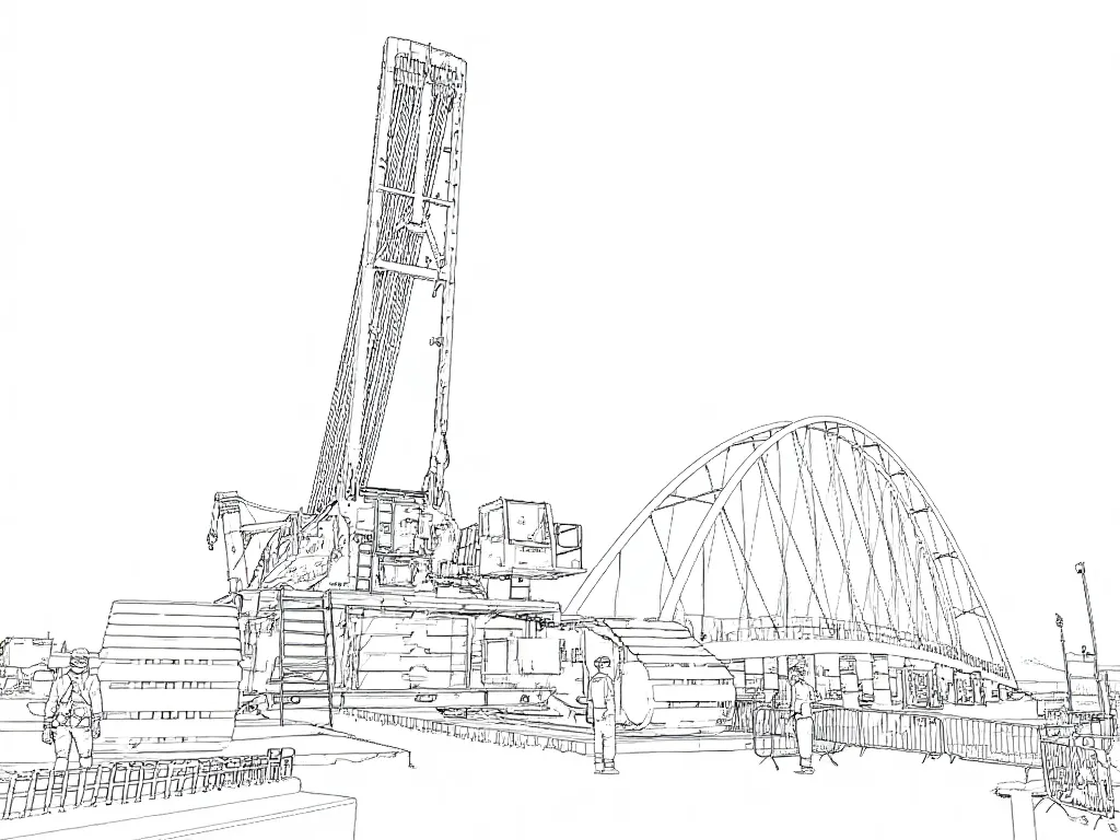
Print off these sheets for children (or adults!) to colour in their own bridge.
- Colouring sheet 1 – new bridge once its complete
- Colouring sheet 2 – new bridge
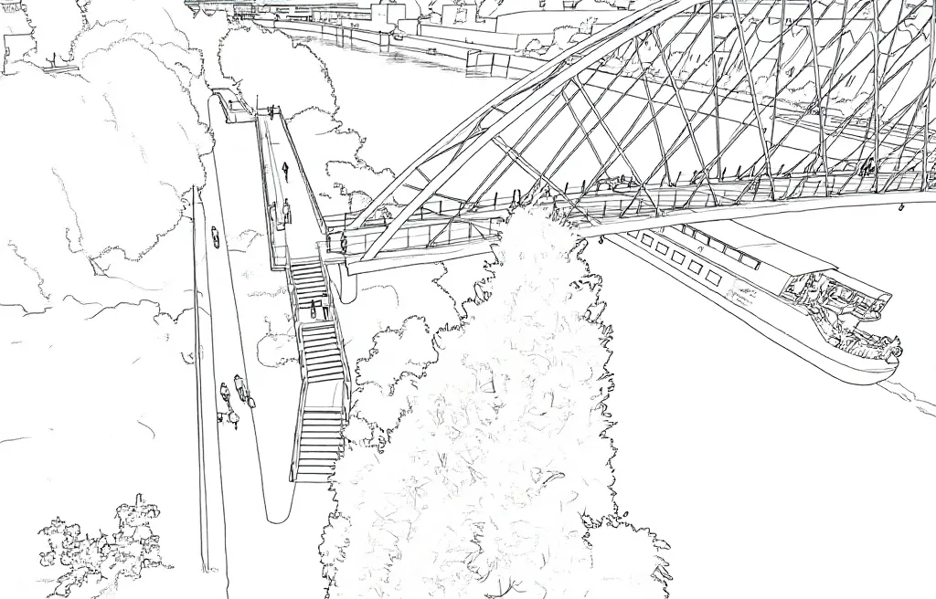
- Colouring sheet 3 – crane preparing to lift the bridge into place


